
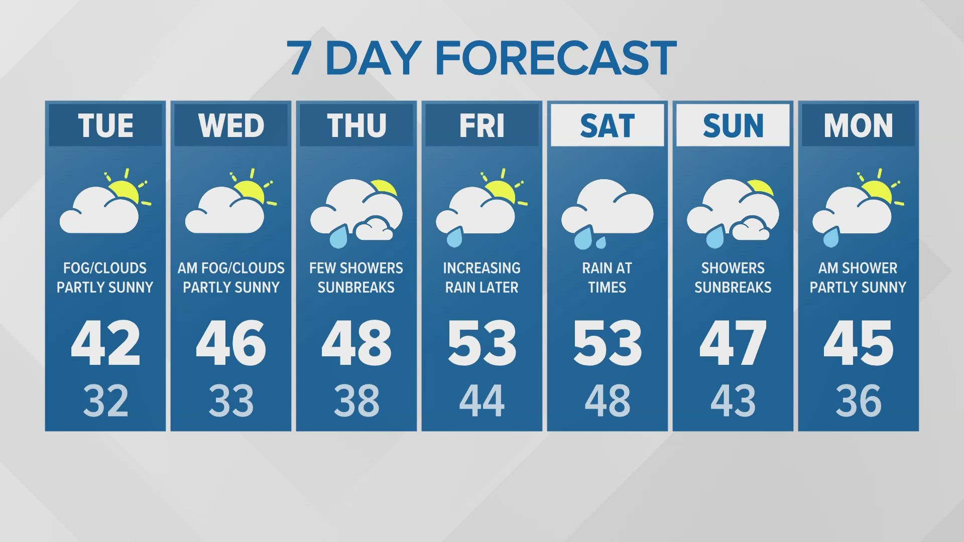
SEATTLE — Puget Sound Extended Forecast
Tuesday-Wednesday: Morning clouds and fog turning partly sunny in the afternoons. Lows in the 30s. Highs in the mid- to upper 40s.
Thursday: Few showers and sunbreaks. Lows in the 30s to low 40s. Highs in the upper 40s to low 50s.
Friday: Increasing rain later in the day. Lows in the upper 30s to low 40s. Highs in the upper 40s to mid 50s.
Saturday: Rain at times. Lows in the low to mid 40s. Highs in the upper 40s to mid 50s.
Sunday: Showers and sunbreaks. Lows in the low to mid 40s. Highs near 50.
Monday: A few morning showers with afternoon clearing. Lows around 40. Highs in the mid to upper.
Discussion
Fog and freezing fog reformed overnight, but not quite as widespread as Monday and not as dense in many areas.
The dry weather is due to a ridge of high pressure that has settled over the region.
The ridge starts to weaken and move east of the Cascades tomorrow. This will allow a weakening weather system to bring a few off and on showers to western Washington on Thursday.
A stronger system will move in later on Friday with increasingly steady rain as a warm front moves into the State. The rain continues on Saturday before the cold front moves through early on Sunday morning. This will change the rain to off and on showers and usher in colder air. Snow levels should drop down to around 3,000 feet on Sunday.
However another ridge of high pressure will build off the coast Sunday into Monday decreasing and ending the showers Monday. Tuesday should see a return to our pattern of morning low clouds and fog with afternoon sun. Highs should be in the mid 40s.
The weather this weekend is not great for building up the snow pack. Snow levels will rise to 5,000 to 7,000 feet by later Friday so much of the precipitation will come as rain in the ski areas. By the time the snow levels drop to 3,000 feet on Sunday, it will begin drying out, probably not contributing much to the snowpack.